


At Precision Utility Mapping, we transform complex site environments into clear, actionable datasets that enhance safety, reduce risk, and keep your project moving. We achieve this by delivering high-accuracy spatial, geophysical, and environmental datasets to support engineering design, construction planning, and asset management. Our technical capabilities span subsurface utility detection, topographic surveys, mobile and static scanning, UAV data capture, and integrated geospatial modelling. We deploy industry-leading technologies—including multi-frequency GPR, EML, 3D laser scanning, LiDAR, photogrammetry, and precision GNSS—to acquire, validate, and deliver data to the highest professional standards.
Looking for a particular Precision Utility Mapping employee's phone or email?
Precision Utility Mapping Questions
The Precision Utility Mapping annual revenue was $3 million in 2026.
Ian Stephens is the Operations Director of Precision Utility Mapping.
33 people are employed at Precision Utility Mapping.
The NAICS codes for Precision Utility Mapping are [54137, 54, 5413, 541].
The SIC codes for Precision Utility Mapping are [871, 87].
Top Precision Utility Mapping Employees
-
13
-
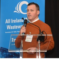
Jonathan Markham
Director at Precision Utility Mapping
Limerick, LK, IE21 -
1
-
Kerim Selcuk
CAD Technician and Surveyor at Precision Utility Mapping
Coventry, England, GB -

Alex Brown
Senior Surveyor at Precision Utility Mapping
United Kingdom1


Related Companies


