The benefits of having geospatial data include better integration and improved effectiveness, resulting in better outcomes and efficiencies. Understanding the geography around us is essential. Our services can address a community’s concerns such as: - Are our roads in the right place? Should we build more? Where? - Is our public transportation network sufficient? - Does it make sense to build houses at a particular location? (is it a floodplain and if so, what would be needed to build there and how much money would be needed to make it safe) - Can we legally build houses here? (is the area a conservation area or other protected land)? Recognized since 1967 for exceptional technical ability, meeting deadlines, and completing projects within budget, our standards have earned us the respect of our long-standing clients. Our staff consists of ASPRS-certified photogrammetrists, FAA-certified pilots, FAA-Part 107 Drone pilots, aerial photographers – as well as LiDAR, mapping, and digital imaging technicians.
| Website | http://aerocon.com |
| Revenue | $5 million |
| Employees | 4 (0 on RocketReach) |
| Founded | 1967 |
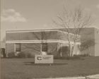
| Address | 4515 Glenbrook Rd, Willoughby, Ohio 44094, US |
| Phone | +1 440-946-6277 |
| Fax | (440) 946-2646 |
| Industry | Civil Engineering, Software Development & Design, Software |
| Keywords | Geospatial Data, Gis Services, Geospatial Analytics, Remote Sensing, Mapping Services, Spatial Data Analysis, Geographic Information Systems, Data Analytics, Gis Solutions, Location Intelligence, Geospatial Solutions, 3d Mapping, Geospatial Technology, Gis Consulting, Cartography, Spatial Analysis, Environmental Mapping, Precision Agriculture, Surveying, Gps Technology |
| Competitors | Esri, GeoIQ, Trimble Inc., Hexagon Manufacturing Intelligence, Maxar Technologies, Fugro, Airbus, CARTO, Planet, GeoSystems Consultants, Inc. +40 more (view full list) |
| SIC | SIC Code 87 Companies, SIC Code 871 Companies |
| NAICS | NAICS Code 54 Companies, NAICS Code 541 Companies, NAICS Code 54137 Companies, NAICS Code 5413 Companies |
Looking for a particular Aerocon Geospatial Services employee's phone or email?
Aerocon Geospatial Services Questions
The Aerocon Geospatial Services annual revenue was $5 million in 2026.
Aerocon Geospatial Services is based in Willoughby, Ohio.
The NAICS codes for Aerocon Geospatial Services are [54, 541, 54137, 5413].
The SIC codes for Aerocon Geospatial Services are [87, 871].
Related Companies